VANCOUVER ISLAND, BC – While most drivers curse at potholes and wonder why their city can’t seem to fix roads fast enough, two forward-thinking communities on Vancouver Island have quietly launched what might be the biggest revolution in road maintenance since the invention of asphalt itself.
And the best part? It’s working so well that other cities are already lining up to copy their approach.
The Million-Dollar Problem Every City Faces
Picture this: You’re David Thompson, tasked with maintaining over 550 kilometers of roads in Nanaimo. Every day, construction crews tear up streets. Weather pounds the pavement. Heavy trucks leave their mark. And citizens – rightfully frustrated – call city hall demanding answers about why their street looks like a war zone.
“We’ve got over 500 kilometers of roadways and at this time of year, they’re constantly getting ripped up and repaired,” Thompson, Nanaimo’s acting manager of public works, told reporters recently. His voice carries the weight of someone who’s spent years fighting an uphill battle against deteriorating infrastructure.
It’s a story playing out in virtually every city across North America. Traditional road assessment methods are expensive, time-consuming, and often outdated by the time the reports are filed. Cities hire contractors with specialized laser equipment every few years, spending anywhere from $180,000 to $200,000 for a comprehensive road survey that takes weeks to complete.
By the time the data is processed and decisions are made, half the roads have changed again.
But Thompson and his counterpart in nearby Victoria have stumbled onto something that’s changing everything.
The Finnish Solution That’s Revolutionizing Road Repair
Enter RoadAI, a deceptively simple system developed by Finnish company Vaisala that’s making traditional road surveys look as outdated as horse-drawn carriages.
Here’s where it gets interesting – and a little bit genius.
Instead of sending out expensive specialized vehicles with laser equipment, Nanaimo simply mounted two smartphones on the windshields of their regular municipal trucks. That’s it. No million-dollar equipment. No dedicated survey teams. Just smartphones doing what smartphones do best – recording video.
But here’s where the magic happens: As city workers go about their daily routines – checking water meters, responding to service calls, or just driving between job sites – those phones are quietly filming every street, every intersection, every piece of pavement they pass.
The video gets uploaded to the cloud automatically, where artificial intelligence takes over. The AI examines every frame, identifying potholes, assessing pavement quality, checking road markings, and even evaluating the condition of street signs. Within four to six hours, Thompson has a complete analysis of road conditions mapped against the city’s geographic information system.
“We can basically re-inspect any piece of road, anytime we want,” Thompson explains, and you can hear the excitement in his voice. It’s the excitement of someone who’s found a solution to a problem that’s plagued him for decades.
The Numbers That Will Make City Councils Weep With Joy
The financial impact is staggering. Nanaimo’s RoadAI system costs approximately $40,000 per year. Compare that to their old method – hiring contractors every three to five years at $180,000 to $200,000 per survey.
Do the math: Over a typical five-year period, the traditional approach cost around $200,000 and provided data that was often months or years out of date. The AI system costs $200,000 over the same period but provides real-time, continuously updated information.

Thompson calls it “a bargain,” and he’s not wrong.
But the real revolution isn’t just in cost savings – it’s in capability. Under the old system, if Thompson wanted to check the condition of a particular street, he’d either have to wait for the next expensive survey or send out a crew for a visual inspection. Now? He pulls up his computer and reviews high-definition video of any street in the city, complete with AI analysis of problem areas.
Victoria Takes a Different Approach – With Equally Impressive Results
About 100 kilometers south in Victoria, Simon Upshon was facing his own version of the same headache. As the city’s acting assistant director of public works, he was fielding constant complaints about potholes across Victoria’s 270 kilometers of roads.
Victoria chose a different AI solution – Rover AI from New York-based CITYROVER – but the principle is the same. For less than $5,000 per month, they mounted a single camera on their street sweeper. As the sweeper makes its regular rounds every six weeks, the camera captures video that AI software analyzes for pavement inconsistencies.
The results? Upshon reports they’re getting fewer pothole complaints than ever before.
“Having the AI tool allows us to be a lot more proactive,” Upshon explains. “We started it as a six-month trial, but we saw value in it very quickly so we’ve extended it all the way through and we still use it today.”
The system provides exact GPS coordinates for every pothole, complete with photos. Road crews know exactly where to go and what they’ll find when they get there. No more hunting around neighborhoods trying to locate the problem a citizen reported.
The Technology That’s Changing Everything
What makes this revolution possible is the convergence of several technologies that have finally matured enough to work together seamlessly:
Computer Vision: Modern AI can analyze video footage and identify road defects with accuracy that often surpasses human inspectors. The systems are trained on thousands of hours of road video, learning to spot everything from hairline cracks to major potholes.
Cloud Computing: Video files upload automatically to powerful cloud servers that can process hours of footage in minutes, providing analysis faster than any human team could manage.
Smartphone Technology: Today’s smartphones pack sophisticated cameras and sensors that rival expensive specialized equipment. They’re also everywhere, cheap to replace, and familiar to municipal workers.
Geographic Information Systems: Modern mapping software can precisely locate every identified problem, creating detailed digital maps of road conditions that update in real-time.
The combination creates something that would have seemed like science fiction just a few years ago – a city that knows the condition of every street, all the time, at a fraction of the cost of traditional methods.
But It’s Not Perfect (And That’s OK)
Both cities are honest about the limitations. Thompson notes that the AI struggles with video taken during rain and snow – though he adds that as the technology improves, they can reprocess old video and extract more data from it.
Upshon mentions false readings caused by shadows and other visual anomalies. Victoria still sends crews to verify AI-identified potholes before dispatching repair teams.
But here’s what’s interesting: These aren’t deal-breaker problems. They’re minor hiccups in systems that are already delivering massive improvements over traditional methods.
And the technology keeps getting better. What couldn’t be detected last year might be identifiable today. What requires human verification now might be handled automatically next year.
The Ripple Effect: Beyond Potholes
The implications extend far beyond road maintenance. These AI systems are proving several concepts that could transform municipal services:
Leveraging Existing Operations: By building data collection into routine activities, cities maximize the value of existing investments instead of creating new overhead.
Democratizing Advanced Technology: Consumer devices like smartphones make cutting-edge capabilities accessible to smaller municipalities that could never afford specialized equipment.
Continuous vs. Periodic Monitoring: Instead of expensive periodic assessments, cities can maintain real-time awareness of infrastructure conditions.
Other municipal departments are already taking notice. Could the same approach work for monitoring parks, tracking snow removal effectiveness, or assessing the condition of municipal buildings? The possibilities are intriguing.
The Human Factor: Why AI Isn’t Replacing Workers
Despite the advanced technology, human expertise remains crucial. Thompson and his team still make decisions about repair priorities, manage complex logistics, and apply contextual knowledge that AI can’t match.
Upshon’s crews still verify AI findings and prioritize repairs based on severity. The most serious potholes get recycled asphalt from the city’s plant, while smaller cracks are sealed with rubberized compounds to prevent expansion.
This human-AI collaboration model may represent the optimal approach for municipal services – AI handles data-intensive analysis while human professionals apply judgment and make strategic decisions.
What This Means for Other Cities
The success stories from Nanaimo and Victoria are attracting attention from municipalities across Canada and beyond. The model offers hope for cash-strapped cities struggling with aging infrastructure and tight budgets.
Key lessons for other municipalities include:
Start Small: Both cities began with trials, allowing them to prove value before making long-term commitments.
Integrate Don’t Disrupt: The most successful implementations work with existing operations rather than requiring entirely new workflows.
Focus on Cost-Effectiveness: The dramatic savings compared to traditional methods make compelling business cases for city councils.
Plan for Learning: Both cities acknowledge they’re still discovering new ways to use their systems more effectively.
Looking Ahead: The Future of Smart Cities
As Thompson noted, there’s “way more work to be done than we can accomplish with the budgets and staffing,” so the focus becomes “what is the best bang for the buck.” AI tools help make those decisions based on data rather than guesswork.
The technology continues evolving rapidly. Future systems may predict where problems will develop, not just identify existing ones. Integration with traffic management, emergency services, and urban planning systems could create comprehensive smart city platforms.
Cost reductions seem inevitable as adoption spreads and technology improves, potentially making these systems accessible to even the smallest municipalities.
The Bottom Line
The transformation happening in Nanaimo and Victoria represents more than just a technology upgrade – it’s a fundamental shift toward evidence-based municipal management. Instead of relying on citizen complaints or periodic surveys, cities can make informed decisions based on comprehensive, real-time data.
For drivers tired of dodging potholes and wondering why their city can’t keep roads in decent condition, these AI systems offer genuine hope. The technology enables more proactive maintenance, better resource allocation, and ultimately, smoother roads.
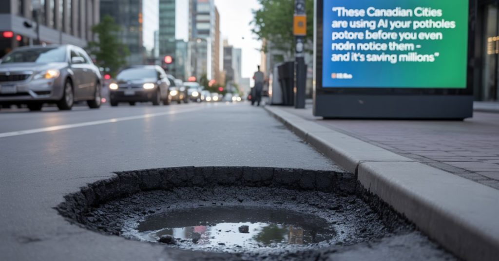
As Upshon noted with obvious satisfaction, the most common complaint to Victoria’s public works department has shifted from pothole reports to complaints about road construction – often work crews fixing potholes the AI system identified before citizens even noticed them.
That might be the best measure of success: When your biggest problem becomes citizens complaining that you’re fixing too many roads too quickly, you’re probably onto something revolutionary.
The AI revolution in road maintenance is just beginning, but the early results from these Vancouver Island pioneers suggest the destination is worth the journey. For cities worldwide struggling with infrastructure challenges and budget constraints, the message from Canada’s west coast is clear: The future of road maintenance isn’t just smarter – it’s already here.